
Learning to Use Layers
by Beth Bastiaans and Dan Johnston
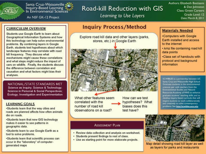
What factors influence roadkill densities on our streets and highways? What steps can we take to protect wildlife? In this 2-hour module, students use Google Earth to learn how Geographical Information Systems (GIS) technology can help solve environmental problems. They also develop and test their own original hypotheses about roadkill, a familiar, local environmental issue. By combining multiple GIS layers in Google Earth, students develop and test hypotheses about which other landscape features may be correlated with roadkill frequency. Finally, the students discuss the difference between correlation and causation and what factors might bias their analyses.
Docs: Fulltext.pdf
Keywords: argument, causation, cause, communication, correlation, data, HS-ESS3.C, HS-ETS2.A, HS-ETS2.B, explanations, GIS, investigations, layers, math, patterns, questions, roadkill, systems